|
|
|
In-house advertising: |
 |
|
|
|
Welcome to the GPS to Map App
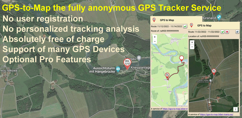
A service from the Beaver-Mania team, when you're on the road  , between games! , between games!
How to use the App?
The GPS to Map App replaces the web interface and the display link with an interface specially developed for mobile devices. Before the app can be configured for your own GPS device, the GPS device must be set up and send data to the GPS-to-Map server. How to do this is described on the main page.
Essentially, the app has two views. One view to set preferences and another to work with the app and view data. Depending on the program version, Standard or Professional, a different number of options are available. The change from the standard version to the professional version takes place directly in the app via a GPS-to-Map Pro subscription.
1. The workspace
|
 |
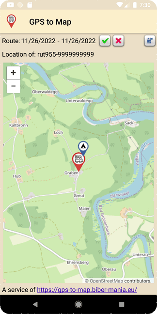
As usual, the current GPS position is displayed on the main page.
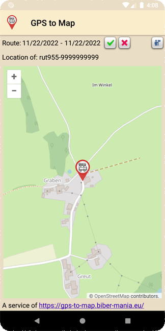
 takes you to the route view, but by default no data is saved. takes you to the route view, but by default no data is saved.
The GPS-to-Map Route View Service is a standalone service that can only be activated through a Pro Subscription. It works like a diary where you can start and stop recording at any time. Here, too, all data remains completely anonymous and access is only possible via the specified password! See also under settings.
Tapping on the date display opens a dialog where the period can be changed.
If you want to open the diary in a web view or allow others access, you can use a link with the following format:
https://gps-to-map.biber-mania.eu/{Devicetype}route-{Serialnumber}
Just try it with this link:
https://gps-to-map.biber-mania.eu/rut955route-9999999999 (Password: demo)
With  you get back to the position view or refresh the location display. you get back to the position view or refresh the location display.
Tapping the button  takes you to the Settings dialog. takes you to the Settings dialog.
(The switch may take a while when tapping for the first time)
|
2. The settings
|
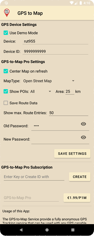 |
Use Demo Mode: The Pro functions can be tried out in demo mode
Device: Devicetype i.e. rut955
Device ID: The identifier or serial number of the device
Center Map: Centers the map in the position display when the GPS position changes
Map Type: Map views (simply try it out)
Show POIs: Here you can switch the view of POIs (private/public/all) on and off. A perimeter can be defined with Area. See also POIs below.
Save Route Data: The recording (diary function) of the route data is activated or deactivated here. A password must have been set to activate.
Show max. Route Entries: Maximum number of route points to be displayed. If the specified period contains more points, the last X points are displayed.
Old Password: The existing password, leave it blank when setting it for the first time
New Password: New password (Attention! There is no forgotten password function!)
Enter Key: License code of a GPS-to-Map Pro version, permanently replaces the Google Pro subscription and can only be purchased at the Beaver-Mania Team. (Not possible anonymously!)
GPS-to-Map Pro: A Google In-App Pro subscription can be ordered using the button next to it. By subscribing the GPS update interval is automatically reduced from 10 minutes to 60 seconds (no need to keep the App open for this). Your personal data remain within Google and will not be stored on the GPS-to-Map server!
|
3. POI (Points of interest)
|
 |
If you tap on the marker of the current position in the position view, a dialog opens where you can set a POI:
 |
Image: A suitable image can be selected here.
Set Privacy: Here you can specify who can see the POI (private = only you, public = everyone)
Comment: Free text that describes the POI or provides additional information.
(Here you can also simply attach notes and keep a kind of diary.)
| 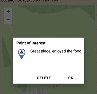 |
If you tap on a POI symbol, the information of a POI can be called up and this POI can also be removed here.
Of course, other users public POIs cannot be deleted here and are visualized via a text overlay.
|
|
|
|


 Deutsch